x
hclab. 都市研究室エイチシーラボ

Main menu

Skip to content
  • ホーム
  • works
  • people
  • ダウンロード
    • hclab. StreetView 起動テスト
  • オフィス

Monthly Archives: 2月 2015

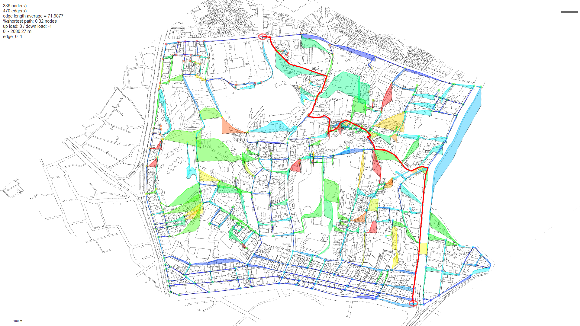
実験, 研究

Shortest path on directional weighted graph (street network) 坂道の負荷によって異なる最短経路

Author hclab Date 2月 23, 2015
This example is about Tokyo Akasaka area. formula of up/down weighted consent-distance h: level...
1 Comment |
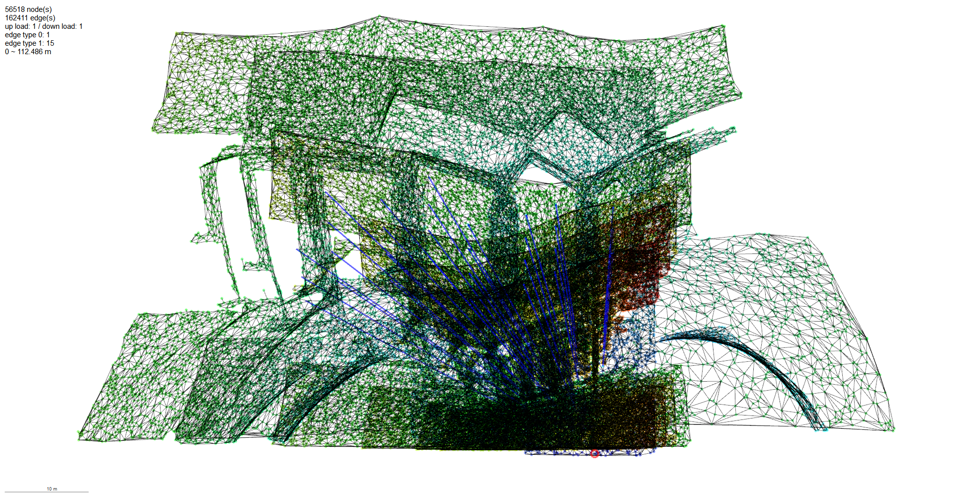
実験, 研究

新宿三井ビル基準階の時間地図

Author hclab Date 2月 23, 2015
measuring OBSTACLE AVOIDING distances by graph(network) from random delaunay mesh 建物の連続平面をランダムドロネー網によって離散化し、グラ
Categories
  • news
  • Uncategorized
  • 出版
  • 実験
  • 研究
  • 解析
  • 講演・レクチャー
Latest Posts
  • 内覧会のご案内
  • 早稲田まちづくりシンポジウム2019
  • GA JAPAN 156
  • エンジニアド・デザイン ──一点突破から考える工学的プローチ
  • 建築情報学会キックオフ準備会議第5回(目黒区・12/14)
  • 鹿児島大学工学部 建築学科+鹿児島支所 特別講演会 2018
  • 2018/11/24 東洋大学大学院経済学研究科公民連携専攻「まちづくりビジネス論 」にて講演を行います。
  • GA JAPAN 152
  • " New working relationship for city regeneration; authorities, companies and citizens "
  • LEXUSミラノデザインウィーク2018
Recent Comments
  • hclab. | ”Time Distance Map” of WTC (World Trade Center) in New York and CCTV (China Central TV) in Beijing: […] represent time distance from entrance to all places in […]
  • hclab. | WTC (NY) , CCTV(Beijing) Time-Distance: […] エントランスからの建物内部各所への時間距離帯連
  • feed back, step プロセスを行う構成 | Adaptive Morphology MAS-GRAPH: […] ↓このあたりのサンプルはすべてこの構成です。
  • hclab. | Sequential Time-map on directional weighted graph (street network): […] 見なし距離を縮める装置としての交通網図 […]
Archives
  • 2019年8月
  • 2019年7月
  • 2019年6月
  • 2019年4月
  • 2018年11月
  • 2018年7月
  • 2018年6月
  • 2018年5月
  • 2018年2月
  • 2017年12月
  • 2017年7月
  • 2016年12月
  • 2016年8月
  • 2016年7月
  • 2016年6月
  • 2016年3月
  • 2016年1月
  • 2015年12月
  • 2015年8月
  • 2015年6月
  • 2015年5月
  • 2015年4月
  • 2015年2月
  • 2014年11月
  • 2014年10月
  • 2014年9月
  • 2013年12月
  • 2013年4月
© hclab. 都市研究室エイチシーラボ